
Using drones for urban regeneration and infrastructure by supporting construction contractors
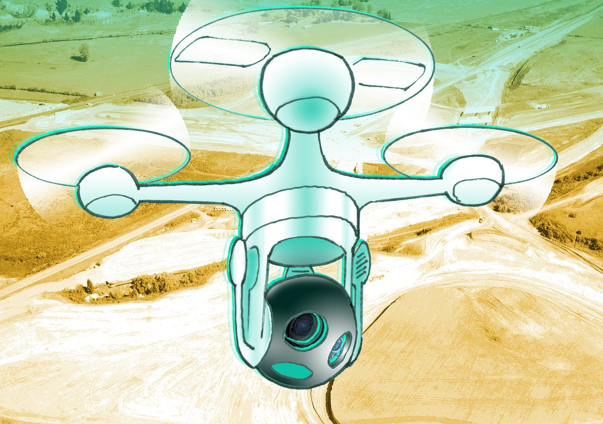
Illustration by ILYA. Background image in the public domain.
This use case focuses on drone services supporting construction work for urban projects in Preston. This would involve routine use of drones prior to and during construction, in order to survey sites and gather real-time information on the progress of works.
- Aerial imagery and sensing provides real-time information to construction managers
- Greater information helps construction contractors complete projects quicker and at lower cost
- Drones can help take workers out of risky environments
- We find that this use case is both technically and economically feasible providing access to restricted airspace is made possible
The key benefits to drones for construction and urban regeneration in Preston would be:
- Increased efficiency in construction site management
- Reduced waste
- Speedier recovery from incidents
- Reduced risk of injury for workers
- Better environmental management
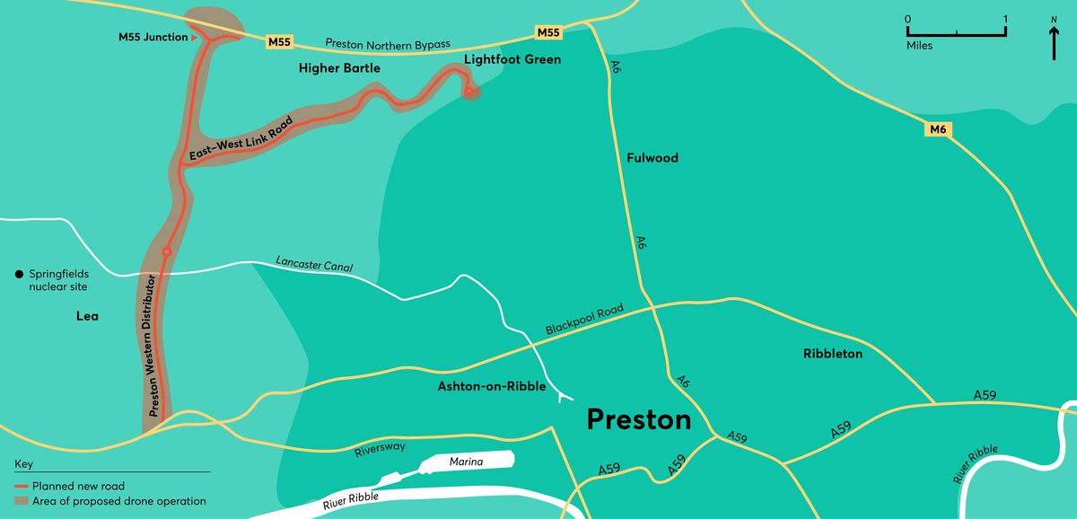
In order to better understand the feasibility of this use case, we have focused specifically on a major forthcoming construction project in Preston that could be a test case for this use of drones. This is the M55 link road project, where a major new road will be built starting in 2019.
Of the use cases we have looked into, this is the closest to being realised already: drones are already widely used in building projects.
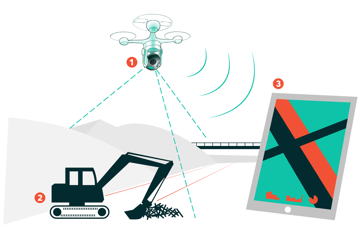
We have explored the use of a drone with cameras, thermal imaging and Lidar to support the construction work there. A drone launched from the construction site would fly in a regular pattern over the construction site in order to gather information on important topics such as the progress of work, location of materials and staff and any safety issues that might be arising.
Of the use cases we have looked into, this is the closest to being realised already: drones are already widely used in building projects. However to be used routinely and as regularly and intensively as we anticipate, the technology needs advances in communications, airspace management and, most of all, autonomous flight - and restricted airspace thanks to a nuclear fuel facility near the site would currently be very challenging to operate in.
Our economic analysis concludes that the use of drones in a construction project such as the M55 link road is highly economically beneficial: we model productivity gains of £15.7m over the 42 months of the project.
Use of drones for this purpose is therefore already feasible, with technological advances enabling wider and more efficient use in future.
Conclusions and recommendations
Conclusions
The Preston use case in summary has strong social and public benefits and is feasible in principle. However, there are a number of challenges that need to be overcome in order to make this use case a reality.
The key challenges (C1-7), based on our analysis, are:
C1. The development of a drone system that can operate safely, securely and reliably beyond visual line of sight, while maintaining appropriate levels of privacy.
C2. The provision of suitably managed, unsegregated airspace allowing for interaction with other airborne systems. (as noted above a key challenge for the specific example of the M55 link road development, is that operation is required within the restricted airspace of the Westinghouse Springfields nuclear fuel facility).
C3. The development of key elements of drone and drone systems technology, with automated data feeds into the building information management (BIM) system and more automated systems that remove routine elements of human interaction, eventually moving to a fully autonomous system.
C4. Being able to operate in low light, at night time and in adverse weather conditions, including high winds, rain, snow and poor visibility.
Recommendations
A. Regulatory change to enable routine drone operations at scale, beyond visual line of sight and near people, buildings or vehicles. (C1 and C2)
B. The development of a new form of airspace management to enable safe automated drone operations at scale. (C1 and C2)
C. Electronic conspicuity devices fitted to all air traffic and integrated into a traffic management system, to improve safety, security, privacy and positive public perception. (C1 and C2)
D. Secure interfaces into other systems and infrastructure with the number of interfaces minimised and encrypted. (C1)
E. Development of technologies that can demonstrate safe operation through high levels of redundancy, including secondary and possibly tertiary systems for command and control, navigation, power and propulsion systems. (C1)
F. Development of counter drone systems to identify and manage unauthorised drone operations, either malicious or accidental. (C1)
G. Development of registration and enforcement systems, with appropriate resources to ensure operator accountability. This should include a centralised database showing licensing of operator competency, the platform ID and airworthiness and the capability to provide real-time monitoring of the airspace. (C1, C2 and C3)
H. Requirement to develop tools and standards for the verification and validation of the drone components, platforms and systems, with traceability of the hardware and software supply chains. This should include development of simulation tools to ensure safe operation and validation of autonomous and machine learning systems. (C1 and C3)
I. Development of appropriate safety cases associated with the use case that could be published and used as standard scenarios to support the regulator and the growing UK industry. (C1 and C2)
J. Establishment of a clear, accountable ownership and sign-off responsibility over the various aspects of operation. This includes maintaining airworthiness, oversight of system upgrades, assurance of pre-flight checks, the flight, associated safety related flight data and appropriate legal accountability and insurances. (C1 and C2)
K. Integration and interoperability between airspace management systems. This will require both technology solutions as well as co-ordinated standards, legislation and process development. (C2)
L. Investigate the possibility of flying partially within the restricted airspace of Westinghouse Springfields nuclear fuel facility. This could be linked to more dynamic airspace management and electronic conspicuity. (C2)
M. Artificial intelligence (AI) developments to support the processing of data feeds to provide valuable and real-time information on all aspects of the construction site, including safety-relevant information, integrated with BIM systems. (C3)
N. Coordination with other aligned technology areas around common challenges which could include collaborations with the robotics and autonomous systems and connected and autonomous vehicle communities. (C3)
O. Development of capabilities to ensure safe flight during adverse weather conditions and at night time. (C4)
P. Development of tests that prove out the capability of the platform and system in representative environments. Leading to trials with growing complexity, moving from controlled environments to full public demonstrations. (C1-4)


